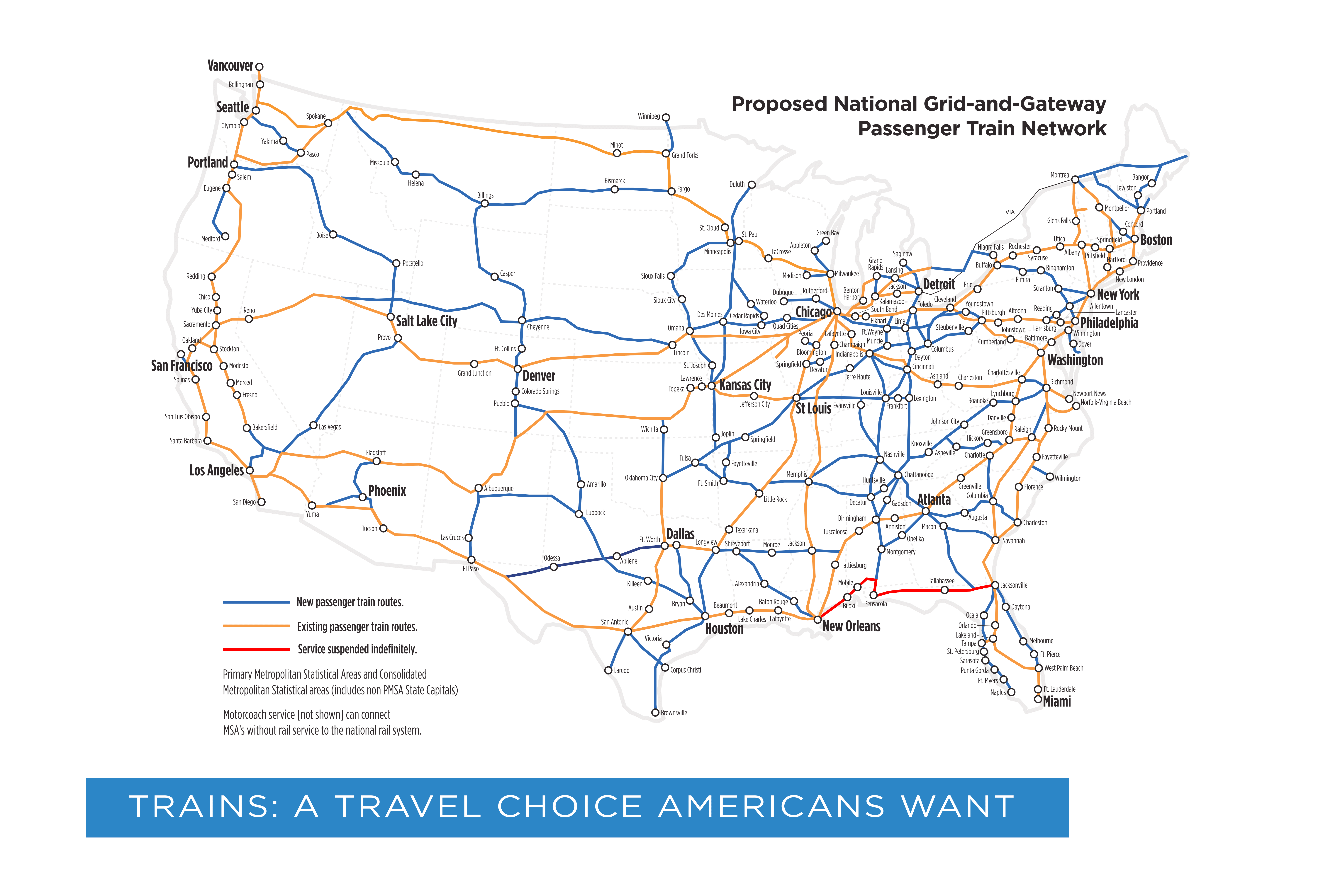
I’ve been looking at those proposed Amtrak maps that keep floating around the Internet.

Just look how compact the rail lines are around Chicago. That makes sense, considering Ohio, Indiana, Illinois and much of the original Northwest Territory came into being around the time of the railroad.
But then again, shouldn’t many southern states like Texas have just as many rail lines all over the place?
I went looking and that’s when I stumbled across a fascinating bit of Civil War-era rail and US history.
States’ rights to never talk to each other, I guess
Abraham Lincoln was inaugurated in March 1860. Up to that point most Presidents took months to get from wherever they were to Washington. But Lincoln was the first generation of “rail presidents”. He was able to come from Illinois, then the frontier west of the US, in about thirteen days. Given the state of the country with President James Buchanan (our worst president. Yes, even worse than that one), this is when people thought, “Maybe we should move the inauguration up to January.”
Anyway, Lincoln’s problem, unlike past presidents like Filmore and Tyler, who got stuck from frozen rivers, snow, mud, and all sorts of carriage-slowing obstacles, was assassination.
Lincoln needed to take a path from Springfield to Washington that stayed as far north as possible. This included Indianapolis, Cleveland, Buffalo, Pittsburgh, New York, and south to Washington. A route he’d repeat in reverse almost by the mile four years later in a coffin.
The problem getting to Washington was a junction in Baltimore, the southern-most city on the tour. Baltimore had two rail stations. One on the north side of town, one on the south. To get between them and change trains you literally had to get in a carriage and let horses wheel you across town.
But why have two stations? Why not have a single station like every other city?
Because while the south had railroads, like this 1855 map shows:
1855 US railways map

They weren’t keen to building them consistently. Railroads in the north were coordinated across state lines to link up and make travel fast and efficient. Rail companies were also keen to standardize time. Up until then, most cities marked “noon” as when the sun was highest in the sky at their location. This meant 12 noon in New York City might actually be 12:15 in Buffalo. Rail roads standardized much of this.
The right to mind your own business
But not in the south. The south used varying steel widths and track types. Partially as a result of having much less steel than the north, partially because states didn’t bother to think ahead about connecting them.
Southern states took this perverse logic so far they were afraid to even approach their state lines out of, I guess, fear someone from the other side would shoot them? Georgia had the most buildout, but lines in the Carolinas, Mississippi, and Alabama were scattershot at best, rarely worked as fast, failed more often, took longer to build, and rarely coordinated across jurisdictions.
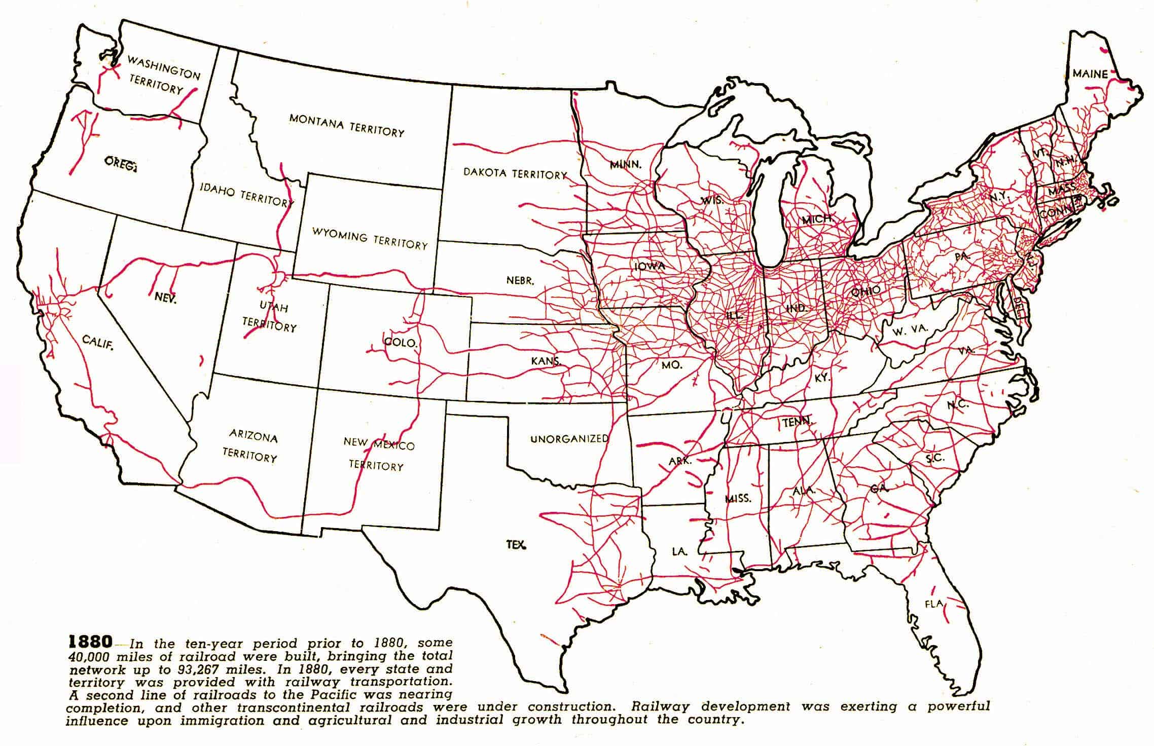
Further complicating rail travel, and why Baltimore was such a weird choke point in US rail networks, is almost no place built rail lines going north to south. By 1880 the north had rail lines everywhere in all directions, while the south had only a couple of north-south lines. This was partially because of early struggles with bridges, but even by 1880, bridge building techniques were a solved problem. Getting across the Ohio River, for instance, wouldn’t have been a problem.
1880 US railways map

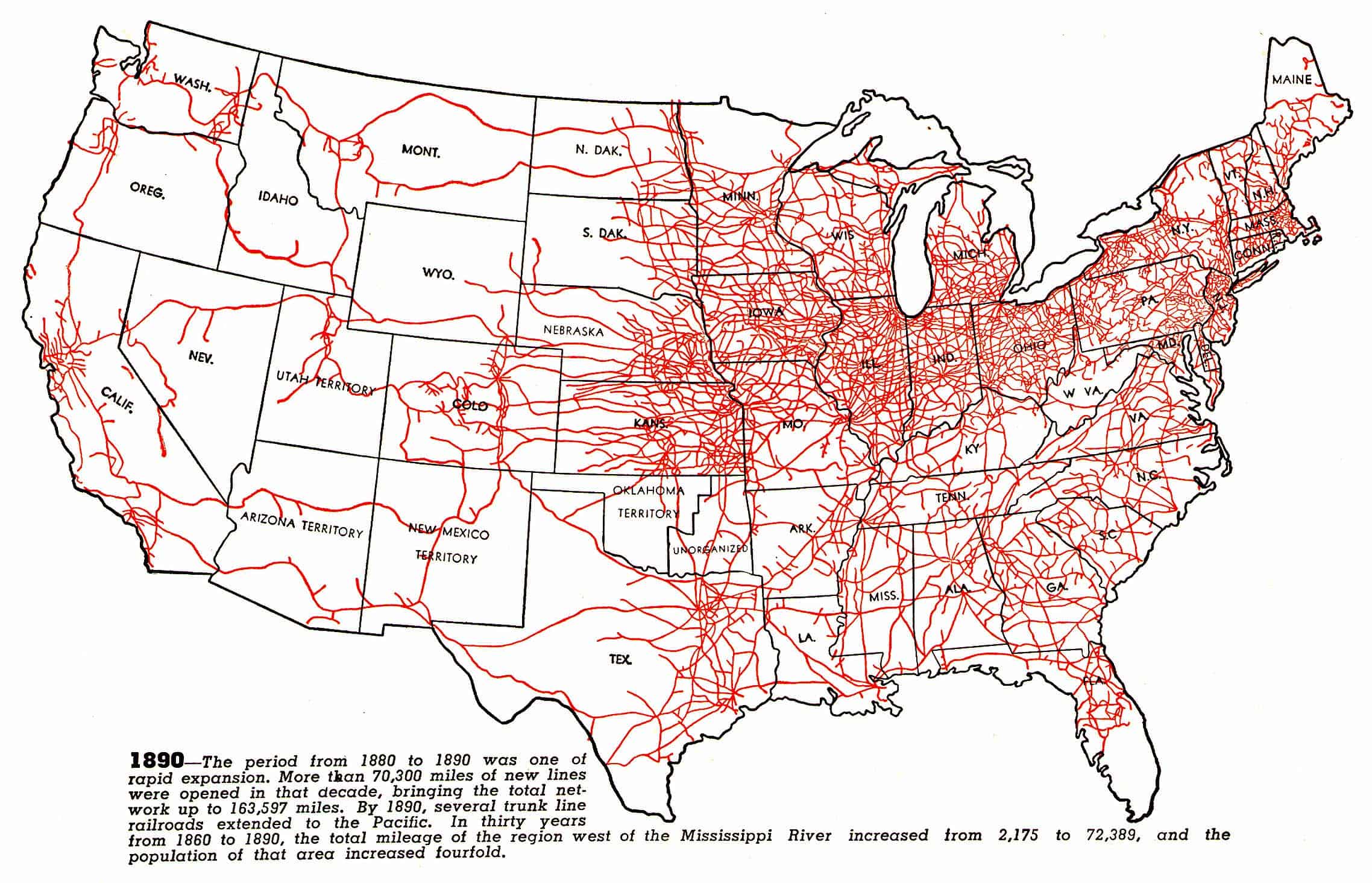
By 1890, the northern states, particularly the (present day) Midwest were absolutely teeming with “iron horses”, even all the way to California.
1890 US railways map

Southern rail lines often went in directions to nowhere, connected scant few cities, rarely crossed state borders, and if they did they realized they didn’t match steel strength or specs. And Texas—not surprisingly—was just a land unto itself pretending no one else existed.
Perhaps all to their peril, since it impeded the movement of people, business, troops, and material.
Similarly, a lack of telegraph wires also hobbled the press, military communication, and sharing of information. When southern towns were decimated by Union soldiers, residents in small villages took to using their chimneys—often the only thing left standing—to send smoke signals.
The south never caught up and seemingly didn’t bother to. Jefferson Davis and General Lee both marveled at the North’s ability to rebuild rail and telegraph wires—“the lightning” as it was called—and the speed they built coverage of both.
Judging by Amtrak’s proposed map, the effects of this are still being felt today.

